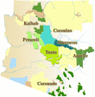
The forest is nestled on the Colorado Plateau. The Mogollon Rim forms the south boundary. Grand Canyon National Park bisects the center of the forest. To the north, the forest extends almost to the border with Utah.
Elevations range from about 3,000 feet to 10,418 feet at the top of Kendrick Mountain. Beginning in low elevation grasslands and sagebrush, the forest steps up through forests of pinyon-juniper and ponderosa pine to fir, spruce and aspen. Summer temperatures range from 50° F at night to 80-90° during the day. Summer thunderstorms, known as the monsoon, can build up quickly, especially during July and August. Snow is common from December through March. -Kaibab National Forest. Here is a Printable Map of the Kaibab National Forest. For more information visit the Kaibab National Forest Web Site.
All of the lakes on the Kaibab National Forest do not require a fee to enter or fish, just if you want to use the campgrounds.
Kaibab Waters
Here is a printable pdf for more information about the resources of the Kaibab National Forest or visit the Kaibab National Forest web site.
- Cataract Lake AZ
- Dogtown Reservoir AZ
- Kaibab Lake AZ
- Kennedy Lake AZ
- Little Hells Canyon "coming soon"

Kaibab National Forest Fishing
National Forest Waters item created by HookedAZ, Nov 2, 2016
Tags. Please type in a Lake Name, Species of Fish etc:

User Comments
Sort Comments By